Home Sensing Primer Glossary Physics Related Technologies Acknowledgements
Instrument profile: QuickBird
A privately owned satellite, projected to be the first of a series, that offers high resolution panchromatic and multispectral imagery.
Usefulness to land managers
Inexpensive, high quality data. Likely to be useful to those who are satisfied with panchromatic or multispectral imagery.
QuickBird offers a product similar to IKONOS or SPOT data.
Costs and Contacts
http://www.digitalglobe.com--The main web site for the parent company.
Overview of prices as of October 2004 are below. Various discounts and rush pricing options are available.
| Archived Library Images | Newly Tasked Imagesa | |||
|---|---|---|---|---|
| per 16.5×16.5km scene | per km2b | per 16.5×16.5km scene | per km2c | |
| Single imagery: panchromatic, multispectral, color, color-IR |
$4896 | $18 | $5984 | $22 |
| Image bundles: pansharpened, or panchromatic plus multispectral |
$6528 | $24 | $7616 | $28 |
|
aPrices are for default processing. Rush tasking is available at higher costs. b25 km2 minimum order. c64 km2 minimum order. |
||||
Sample images
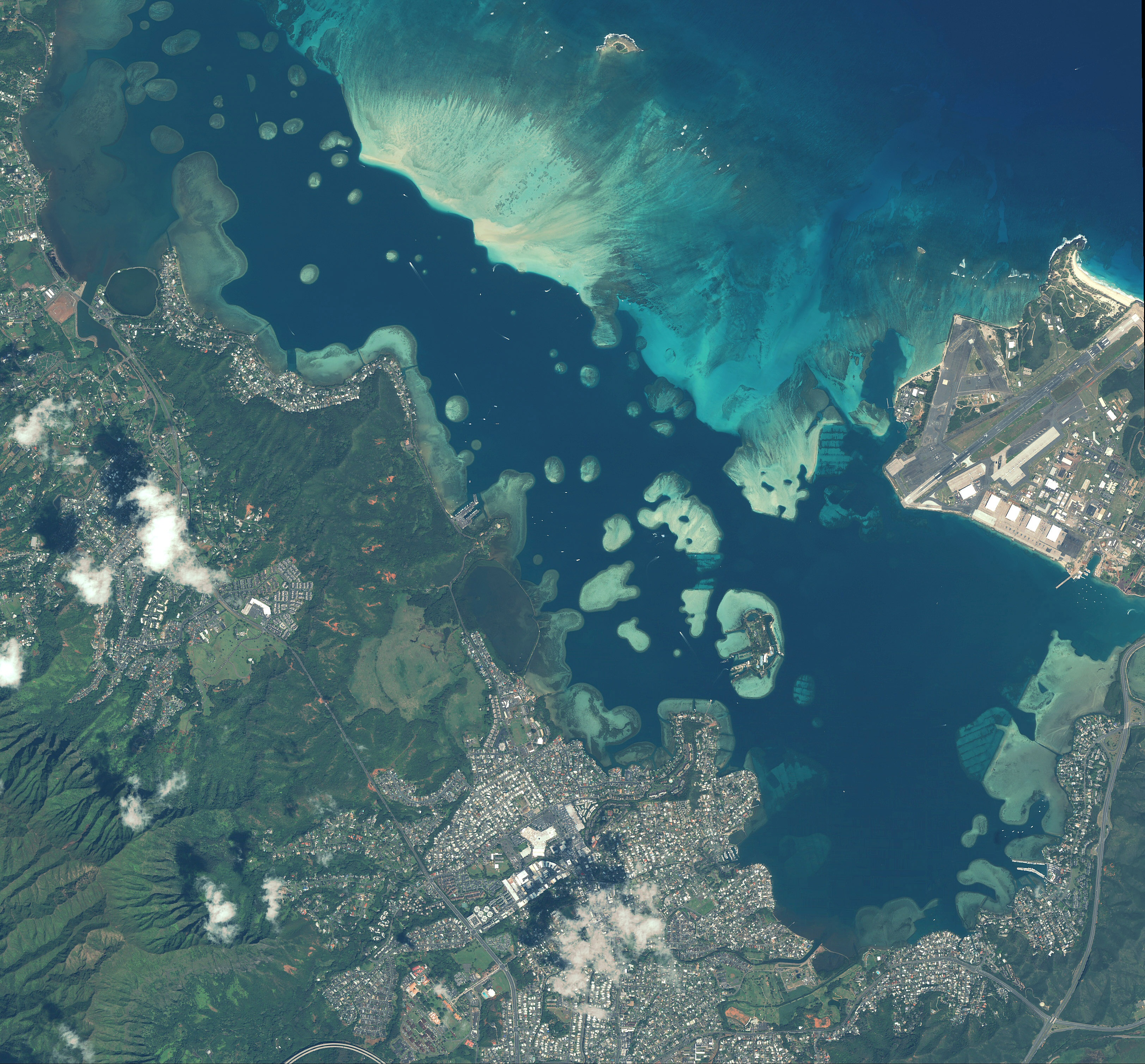 Oahu, Hawai'i 2.4m multispectral |
 Mecca 0.6m pansharpened |
 Ferrol, Spain 2.4m multispectral |
 St. Louis, Missouri 0.6m pansharpened |
Useful Web Sites
See above.
Technical Specs
| Spectral data characteristics | ||
|---|---|---|
| Band | Spectral Coverage | Spatial Resolution |
| Panchromatic | 445-900 nm | 0.61 m |
| Blue | 450-520 nm | 2.44 m |
| Green | 520-600 nm | 2.44 m |
| Red | 630-690 nm | 2.44 m |
| Near-IR | 760-900 nm | 2.44 m |
| Areal data characteristics | ||
| "Scene"=16.5×16.5 km "Image strip"=16.5×165 km |
||
References
http://www.digitalglobe.com--accessed 23 Oct. 2004